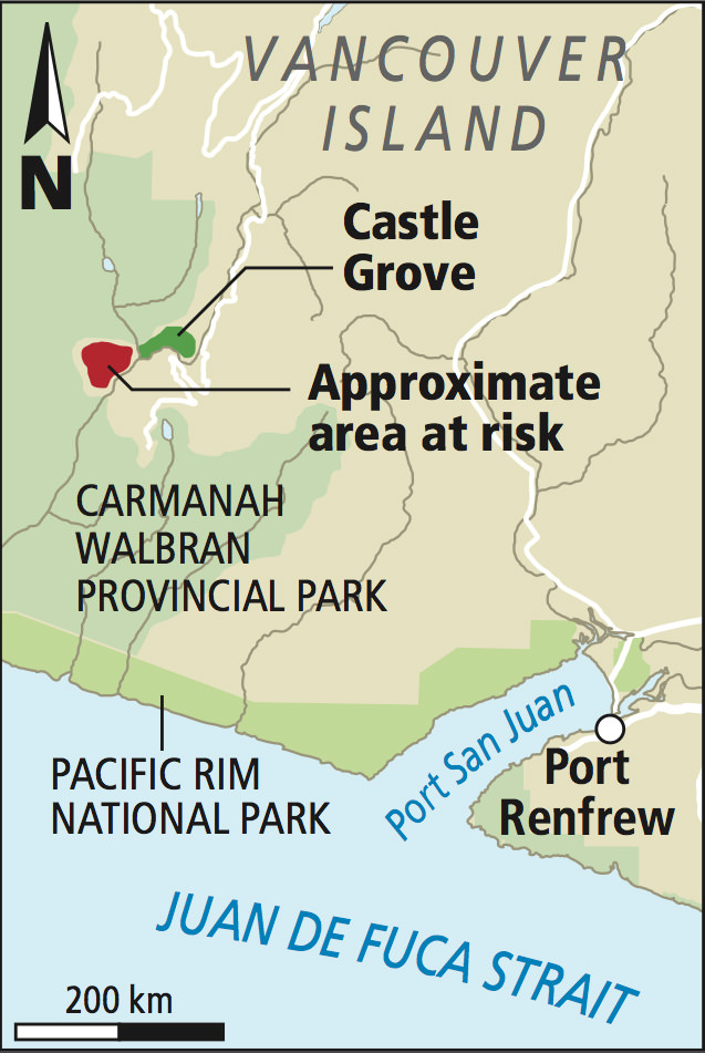
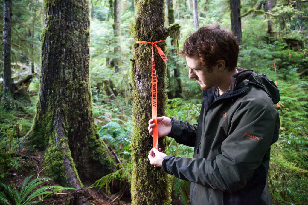
In November 2014, survey tape marked “falling boundary” and “road location” was discovered by hikers in the unprotected portion of the Walbran Valley, one of the most iconic and grandest old-growth temperate rainforests in Canada. Members of the Ancient Forest Alliance went to investigate and confirmed the potential logging threat.
The flagged areas were generally to the southwest of the “Miller’s Monstrosity” clearcut, with some flagging on its north side as well. After a major public uproar, logging licensee Teal Jones only applied for one of the cutting permits, which was granted by the Ministry of Forests but never cut.
In June of 2021, the Central Walbran Valley was temporarily deferred from logging upon request of the Pacheedaht, Ditidaht, and Huu-ay-aht First Nations. Ultimately, we would love to see the entire unprotected portion of the Walbran Valley protected in a legislated conservancy.
*Also pictured are photos of a 2013 clearcut by Teal Jones a few kilometres away in the Upper Walbran Valley.
Take action by sending an instant message to protect old-growth forests.
Photography by TJ Watt.